A powerful atmospheric river is unleashing one of the most extensive flood events in years across the Pacific Northwest, soaking the region with more than 8 to 10 inches of rain in two days and several more inches expected through Thursday. Rivers in Washington, Oregon, Idaho, and Montana are rapidly rising toward, and in some cases beyond, major flood stage, prompting wide-ranging warnings, rescues, and emergency declarations spanning a four-state region.
A Single Storm System’s Cascading Impact Across Multiple Rivers
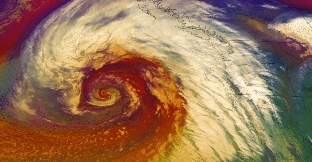
Forecasters have rated this atmospheric river a Level 4 out of 5, placing it among the strongest such systems to hit the region. A focused plume of Pacific moisture is streaming into the Cascades, Olympics, and coastal ranges, forming a persistent band of intense rainfall visible on satellite imagery. The broad geographic reach of this system is what makes this flood event particularly dangerous—multiple river systems across four states are simultaneously being pushed toward crisis levels by the same storm.
According to the National Oceanic and Atmospheric Administration (NOAA), as many as 34 gaged locations along major streams and rivers across the Pacific Northwest have reached or are forecast to reach moderate-to-major flood stage this week. In Washington State alone, forecasters predict that approximately 18 major river locations will reach major flood stage this week—a critical threshold that represents one of the state’s most widespread simultaneous river emergencies.
Major flooding is unfolding across Western Washington, where multiple rivers are cresting at dangerously high levels. More than 20 river flood warnings are in effect across multiple basins, and officials note that some waterways may not crest until days after the heaviest rain ends. That lag raises concern that already swollen rivers will continue to climb even as skies begin to clear, keeping communities on alert well into the week.
The Pacific Northwest is no stranger to these moisture corridors during winter, but forecasters say the combination of this system’s strength, duration, and timing has created an unusually broad and dangerous flood setup.
When Drought And Downpours Collide
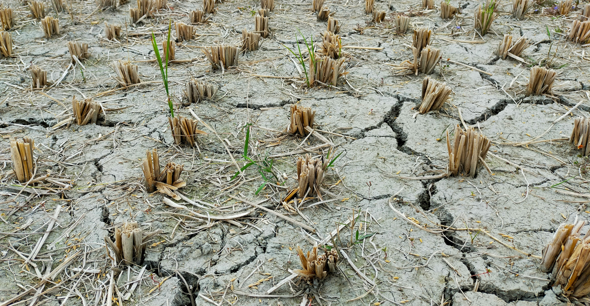
Months of dry conditions have primed the landscape for rapid runoff rather than gradual absorption. The Pacific Northwest has endured a three-year drought that left parched, compacted soils unable to absorb heavy rainfall. These soils are now shedding water instead of soaking it up, feeding torrents into streams and rivers at high speed. That has turned what might otherwise be a manageable wet spell into a fast-developing flood emergency.
Rivers are now surging toward or beyond major flood thresholds. In Washington, the Snohomish River is forecast to crest near 32 feet on Thursday, within striking distance of its 33.5-foot record. The Skagit River is projected to climb well above past highs, potentially cresting 3 to 5 feet above previous records. Multiple additional rivers including the Snoqualmie, Skykomish, Puyallup, and White rivers are expected to reach major flood stage. The Grays River, located in southwestern Washington, has already reached 33.36 feet, shattering its previous record of 33.15 feet set in 2007.
In Oregon, rivers including the Willamette River in Oregon City are forecast to rise by more than 5 feet, while the nearby Clackamas River may swell by more than 13 feet. Flood warnings have been issued for the Siletz, Cowlitz, Nehalem, Grays, Wilson, and Pudding rivers. The Blue Mountains region of eastern Oregon is facing the threat of minor flood stage on several river systems as snow levels rise due to the atmospheric river’s warm, moist air mass.
Farther inland, northern Idaho and western Montana are contending with a different but related set of problems. Moisture from the atmospheric river is combining with colder air and higher elevations to produce heavy snow, triggering avalanche warnings and increasing the risk of road closures and isolated communities. Across the region, the unfolding situation is being shaped by overlapping threats: rising water, unstable slopes from saturated soils, and difficult travel.
Rescues, Damage, And Emergency Declarations
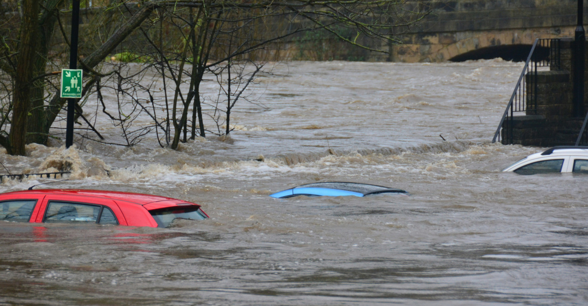
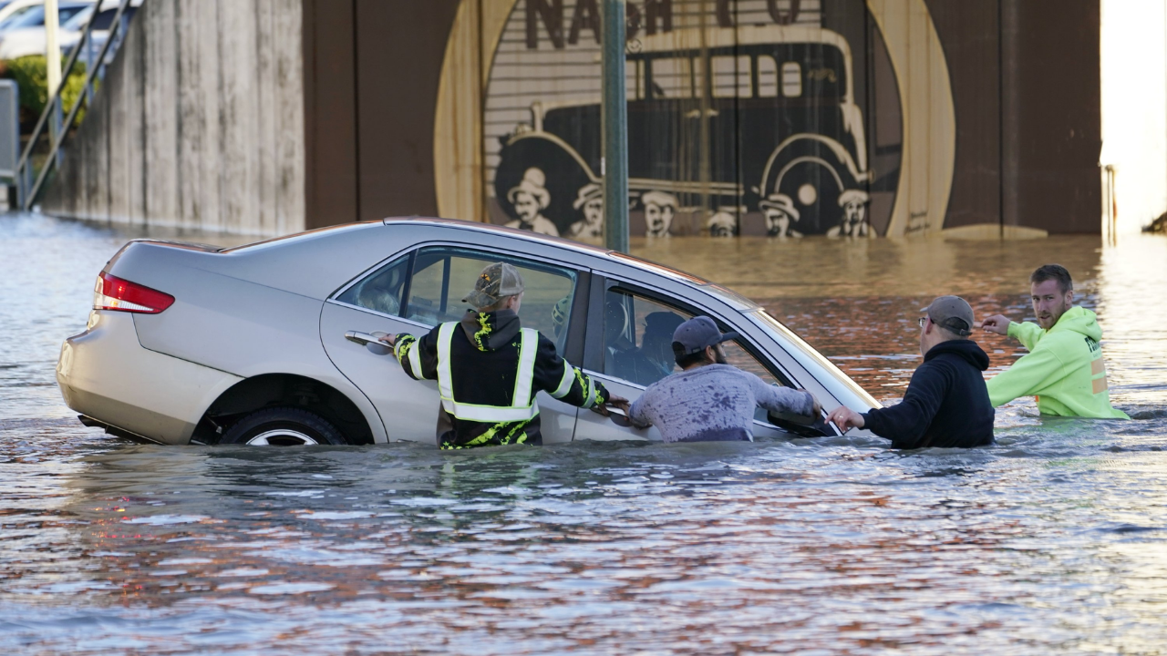
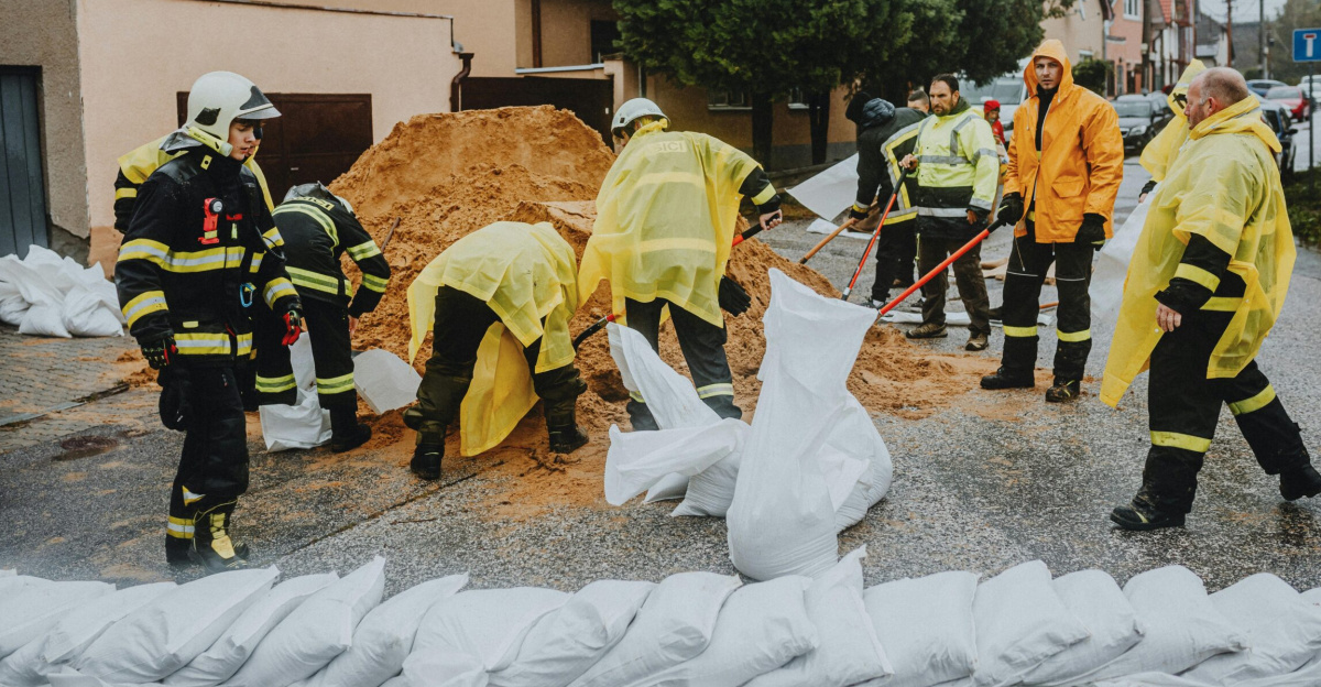
On the ground, the impacts are already substantial. Along the I-5 corridor between Portland and Seattle, emergency crews have carried out rescues after drivers were trapped by rapidly rising water on flooded roadways. In Washington’s coastal counties, rivers such as the Grays and Naselle are threatening homes, farms, and local roads; the Grays River has reached 33.36 feet, while the Naselle is nearing its record crest. Mudslides and debris flows are cutting off routes just as residents and officials attempt to evacuate vulnerable neighborhoods, complicating response efforts.
In response, Washington’s governor has issued a statewide emergency declaration, opening the door for additional state resources to support local response and recovery. Counties including King and Snohomish, as well as the City of Snohomish, have enacted their own emergency proclamations to speed up coordination, funding, and deployment of assistance. As many as 100,000 residents across Washington may be subject to evacuation orders. At the same time, the region’s infrastructure is under strain: landslides have closed key roads through the Cascades and Columbia Gorge, localized flooding is hindering emergency access, and power and communication lines in some areas are at risk from inundation and unstable ground.
Four-State Flood Impacts Reflect Atmospheric River’s Broad Reach
Western Washington faces the most severe flooding, with multiple rivers cresting simultaneously. Communities along the Snohomish and Skagit, among others, are preparing for water levels rarely seen in recent decades. The simultaneous rise of multiple major rivers across the state has stretched evacuation routes and emergency response resources to their limits.
Northwest Oregon has experienced significant flooding along the Interstate 5 corridor, particularly near the Willamette Valley where rivers and creeks are spilling into low-lying areas. The Oregon Coast has seen highway closures including U.S. Highway 101 near Tillamook due to high water and landslides near Neskowin. Flood warnings remain in effect for multiple river systems across northwest Oregon.
Northern Idaho and western Montana are experiencing snow from the atmospheric river rather than rain due to colder mountain conditions. This has triggered avalanche watches and warnings. Rivers in these regions are experiencing increased runoff from the precipitation event, though major river flooding is primarily affecting the lower-elevation areas of Washington and Oregon.
Communities And Planners Look Ahead
As residents cope with immediate damage, longer-term questions are emerging about how communities can better withstand a future in which intense atmospheric rivers may become more common. Hydrologists and climate experts warn that warmer ocean waters and shifting atmospheric patterns are likely to strengthen these storms and increase their frequency. That has intensified calls for improved forecasting, expanded river monitoring networks, and updated floodplain maps so that officials and residents have clearer information about evolving risks.
Local and state leaders are also expected to revisit land-use and infrastructure decisions once the water recedes. Potential measures include reinforcing levees, revising building standards in high-risk zones, and rethinking development in low-lying floodplains that have seen repeated inundations. With rivers across the Pacific Northwest hovering near or above historic levels, the current flood is serving as a test of existing defenses and emergency systems—and a preview of the adjustments that may be required. As the region transitions from response to recovery, the central challenge will be how to adapt homes, transportation corridors, and critical services to a climate where severe, widespread flooding is an increasingly present threat.
Sources
Governor of Washington Official Statement
State of Washington Governor’s Office, December 9, 2025
AccuWeather Meteorological Analysis
AccuWeather, December 9-10, 2025
Seattle Times Weather Coverage
Seattle Times, December 9, 2025
2025 Pacific Northwest Floods Reference
Wikipedia, December 10, 2025
Ground News Aggregated Report
Ground News, December 10, 2025
Center for Western Weather and Extremes (Scripps/UCSD)
CW3E, December 8, 2025