December 2025 brought an unusual sight to Oregon’s Central Cascades, bare slopes, quiet ski lodges, and rain instead of snow. It became one of the warmest and least snowy early winters the region has seen in decades. By early January 2026, snowpack levels were only about 25–28% of normal, the lowest in roughly 75 years of recordkeeping. This record warmth raised not only worries for ski resorts but also for farmers, cities, and wildfire managers, since winter snow acts as the natural water supply for the region through the dry summer months.
The lack of snow hit mountain businesses especially hard. Hoodoo Ski Area, open since 1927, stayed completely closed for December, only the fourth time in its history. Mt. Bachelor, Oregon’s biggest ski resort, delayed its opening despite strong demand. State climatologist Larry O’Neill said the region would need six to ten feet of new snow to return to normal levels, far more than any single storm could bring. As the new year began, attention turned to the skies, and to forecasts of an incoming Arctic storm that could dramatically change the picture, but perhaps too late to fix the damage.
A Changing Pattern in the Pacific Northwest
Climatologists say this difficult start to winter is part of a broader trend. Since 2000, Oregon’s mountain regions have faced poor early-season snow in about four out of every ten years. Warmer autumns and late-arriving cold snaps have become increasingly common, turning what used to be rare warm Decembers into a frequent occurrence. Resorts have tried to adapt with expanded snowmaking systems, but these machines don’t work well when temperatures stay above freezing or humidity is high, conditions that dominated December 2025.
By mid-December, meteorologists predicted a possible shift in the weather pattern. If cold Arctic air pushed far enough south and collided with Pacific moisture, a major snowstorm could form. Around New Year’s, computer models began to agree: a large ridge of warm air stretching hundreds of miles would collapse, opening the door for a surge of Arctic cold. This setup mirrored the kind of strong winter systems that have dumped several feet of snow in past decades across the Oregon Cascades.
The Big Storm Arrives
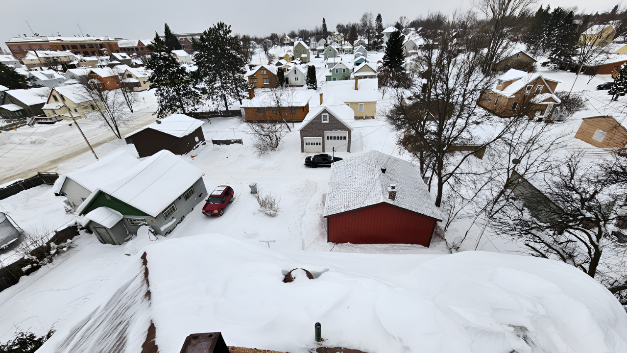
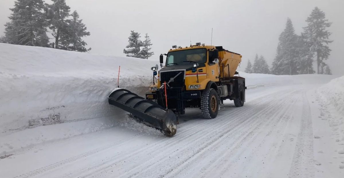
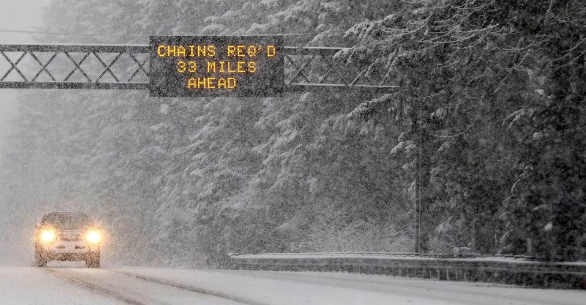
On January 5, the National Weather Service warned of an “Arctic plunge” headed for the Pacific Northwest. Two days later, it issued a Winter Storm Warning for the Oregon Cascades. Forecasters predicted up to five feet of snow above 5,000 feet in just 60 hours, along with strong winds nearing 50 mph. Heavy snow and poor visibility were expected to make travel nearly impossible.
Santiam Pass was forecast to get around 42 inches of snow, and Mt. Bachelor’s summit could see up to 40 inches. The storm threatened to close major routes, including Highways 20 and 242 and Interstate 97, the main connections between Oregon’s major valleys and Central Oregon communities. With more than a million people relying on those roads, officials warned of long delays and urged drivers to carry chains and emergency kits.
For ski areas, the timing felt critical. Hoodoo prepared to open on January 9 if it received at least two to three feet of snow. Mt. Bachelor planned a start the next day. Together, Central Oregon resorts had already lost an estimated $2–3 million in December. Managers cautiously expressed hope that the storm could rescue the season. “It could be a season-saver,” one Mt. Bachelor official told local reporters.
Yet scientists cautioned that one snowstorm wouldn’t solve deeper water problems. Hydrologists with the Bureau of Reclamation noted that while reservoir levels might improve short-term, a single storm wouldn’t fix poor snowpack trends. Rivers like the Deschutes, which supply water to more than 300,000 people, depend on steady snowfall from January through April, not on a single burst of heavy snow.
What This Means for the Future
Even as crews prepared roads and opened lifts, experts looked ahead to what this winter meant for Oregon’s broader climate outlook. Low snowpack years often lead to early, high-risk wildfire seasons. In 2021, the state’s largest wildfire on record, the Bootleg Fire, burned after a winter with only 40% of normal snowpack. A recent U.S. Forest Service memo warned that even a strong January storm would not significantly lower fire risk if snowmelt and runoff stay below 60% of average by spring.
December also brought what some scientists called a water paradox. Because it was so warm and wet, much of December’s precipitation ran off as rain rather than being locked up as snow. That immediate runoff boosted river flows to almost 150% of normal, but the water can’t be reclaimed later when it’s needed most. Larry O’Neill said that much of December’s damage was “permanent” in terms of the 2025–26 water year.
Ski resorts are now facing the reality of a changing climate. Hoodoo has formed a “Winter Reliability Task Force” with state meteorologists and water experts to plan for more variable winters. Mt. Bachelor’s parent company is considering more year-round attractions, following the example of Colorado resorts that rely less on snowfall. Meanwhile, both resorts face limits on snowmaking because it requires freezing temperatures and large amounts of water, resources likely to become scarcer as winters grow warmer.
Scientists emphasize that the January storm is best seen as a short-term relief, not a full recovery. Despite the snow, the Cascade region remains in severe drought according to NOAA. Unless more storms bring snowpack up to at least 80% of normal by April, water shortages and fire risk may persist through 2026.
As the chairlifts begin turning again, one question remains: is this powerful storm a sign that winter is fighting back, or just a brief pause in an increasingly unstable climate? For now, the snow brings hope. But the real test will be how the Central Cascades adapt as the line between winter and spring keeps shifting.
Sources
National Weather Service Winter Storm Warning, January 7, 2026
NOAA Climate Prediction Center, various reports, January 2026
Oregon State Climatologist Larry O’Neill statements and memos, Capital Press, January 5-6, 2026
KTVZ news coverage, December 10, 2025 through January 7, 2026
Hoodoo Ski Area official statements and press releases, January 7-8, 2026
Mt. Bachelor communications and operational reports, January 6-8, 2026