“Everything west of I-5 will be toast,” warned FEMA Director Kenneth Murphy on 12 July 2015. Scientists say a magnitude 9.0+ earthquake along the Cascadia Subduction Zone could devastate millions across Oregon, Washington, California, and Idaho. Coastal cities, critical infrastructure, and supply chains face catastrophic risk.
From violent shaking to towering tsunamis, this is not a distant threat—it is overdue and inevitable. Let’s explore who will be affected and why the Pacific Northwest remains perilously unprepared.
Who Lives in the Danger Zone
Approximately 17 million Americans live above the fault, with 7 million in immediate impact areas, including Seattle, Tacoma, Portland, Eugene, Salem, and Olympia. Vulnerable groups face disproportionate risk.
Elderly residents, disabled populations, and children are particularly exposed. Coastal summer tourists further increase casualties. The concentration of human life along the I-5 corridor sets the stage for widespread tragedy.
The Elderly Face Grim Odds

Oregon’s population is 19.9% age 65 or older, with some coastal counties exceeding 38%. Emergency management acknowledges that evacuation for the elderly is unrealistic.
Kevin Cupples, a local official, stated, “We can’t save them. No. We won’t” on 12 July 2015. This stark reality underscores the human toll that precedes the arrival of the tsunami.
Children and Schools at Risk

Approximately 3,000 schools are expected to collapse or be compromised in the event of a Cascadia earthquake. Gearhart Elementary and Seaside School District campuses sit directly in tsunami zones.
In 2015, student Taylor Barnes noted, “1,600 students had no viable evacuation route.” These vulnerabilities raise chilling questions about how younger populations might survive when disaster strikes.
Tourists Could Increase Casualties

Oregon sees 150,000 summer beach visitors on weekends. If a quake strikes at 2 AM, tsunami models project nearly 19,500 deaths, far exceeding FEMA’s weekday estimate of 13,000.
Visitors’ limited evacuation window of 10–30 minutes amplifies risk. But the tourist factor is only one element of cascading human vulnerability across the region.
Small Business and Economy
Southern coastal production declines by 71%, and employment falls by 81%. Portland Metro experiences a 32% production loss and a 24% employment loss. Restaurants, hotels, and retail cannot survive power or water outages for months or years.
The economic ripple will extend beyond the Pacific Northwest. What begins as physical destruction triggers nationwide disruptions in commerce and daily life.
Supply Chains Will Collapse
21.3 million people rely on regional supply chains for food, medicine, fuel, and essential goods. Cascading failures will create shortages for months to years.
The breakdown will extend across transportation, ports, and pipelines. But understanding the underlying geological cause explains why these failures are inevitable.
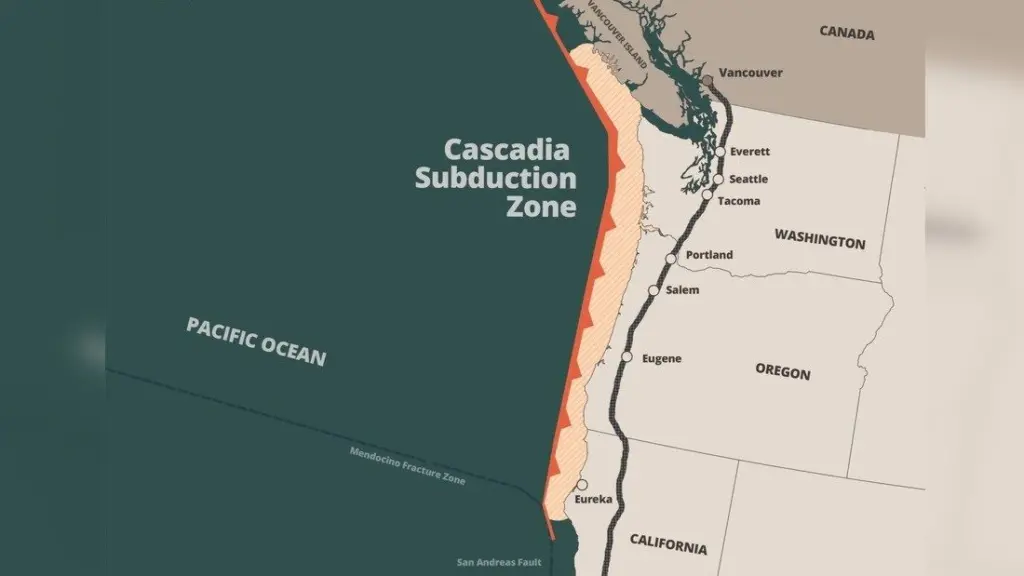
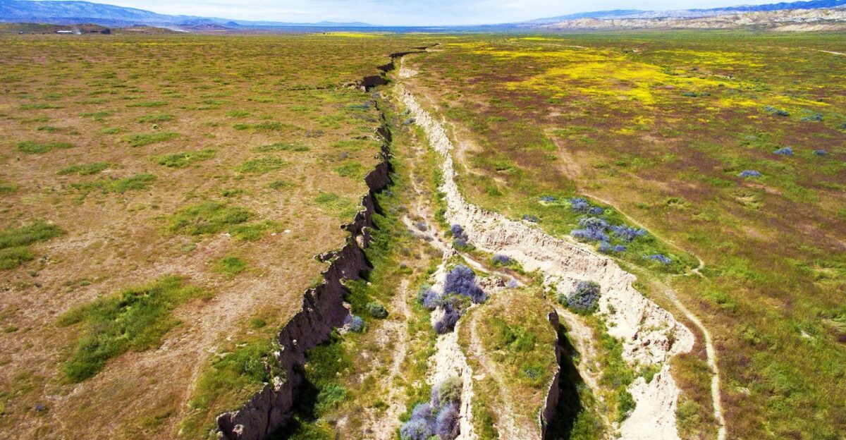
The Fault Behind the Disaster
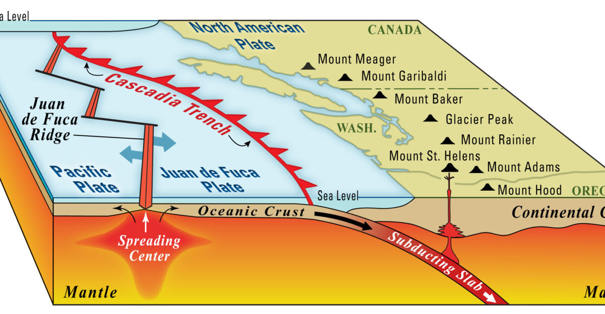
The Cascadia Subduction Zone stretches 600–700 miles from Northern California to Vancouver Island. The Juan de Fuca Plate subducts beneath North America at 30–40mm per year.
Accumulated strain over 325 years will rupture, displacing land 3–6 feet and unleashing unprecedented energy. The geological stage is set for catastrophe.
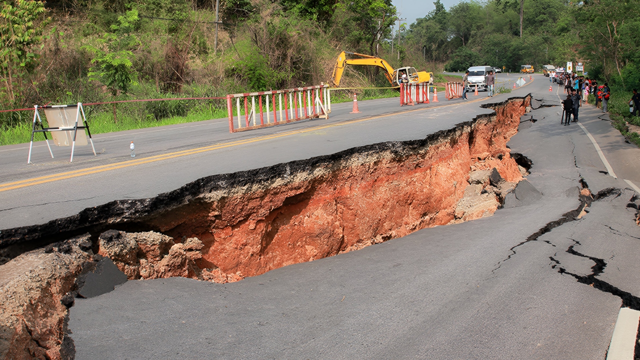
Shaking and Liquefaction
Violent shaking lasts 3–7 minutes depending on location. Up to 1 million buildings, 50% of highway bridges, and two-thirds of hospitals will collapse or be compromised.
Liquefaction will transform ground into liquid, triggering landslides and structural failure. But shaking is just the first act; tsunami waves will arrive within 15 minutes.
Tsunami: The First Wave of Destruction
Tsunamis up to 100 feet high will sweep inland at 30+ mph. The New Yorker described it as “the whole ocean, elevated, overtaking land” with debris carried miles inland.
Coastal residents face minimal evacuation time. The rapid onset will determine who survives. The human toll will be immense and immediate.
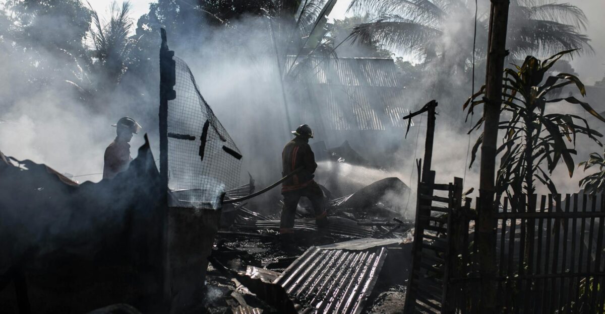
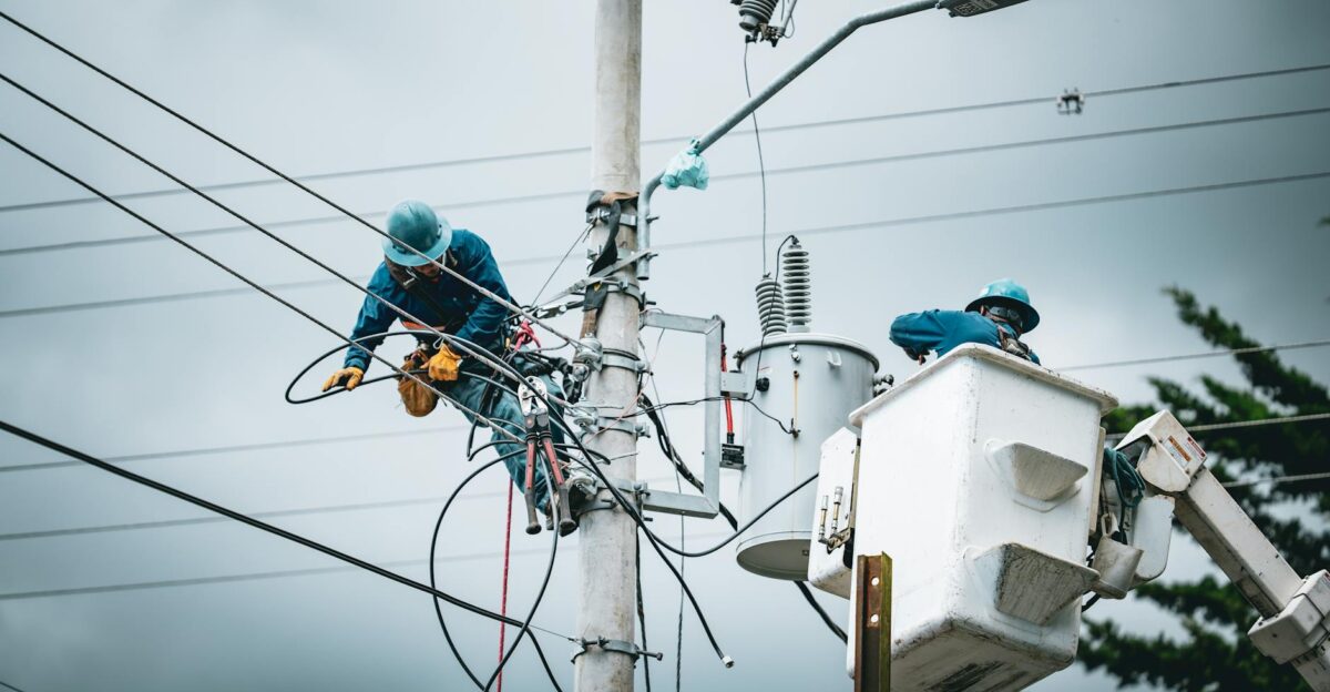
Cascading Failures Amplify Risk
One-third of public safety workers will not respond. Hospitals lose electricity for 3–6 months, water/sewer for 1–3 years. Portland’s CEI Hub faces catastrophic fuel ruptures.
Infrastructure collapse multiplies mortality risk. The interdependence of hospitals, roads, and energy highlights why recovery will take years, not months.
Economic Damage in Numbers
FEMA estimates $220 billion direct damage; total costs may reach $300–500 billion. Hub disruptions cause $10 billion lost annually during recovery.
Economic paralysis compounds human suffering. Even urban areas with partial survival face severe production losses and long-term unemployment.
Historical Context Matters

The last megathrust quake struck on 26 January 1700. Japanese records confirm the orphan tsunami 10 hours later, revealing the event’s exact magnitude and timing.
Paleoseismic evidence shows 41 events in 10,000 years, with 243-year recurrence. At 325 years, the region is statistically overdue, increasing urgency for preparation.
Probability of a Megaquake

USGS 2023–2025 models estimate 10–15% chance of magnitude 9.0+ in the next 50 years. Older 2010 models cited higher odds, but modern data refines expectations.
The statistical inevitability frames human vulnerability. This is not speculative—scientific consensus anticipates catastrophic rupture within our lifetimes.
San Andreas Synchronization Threat
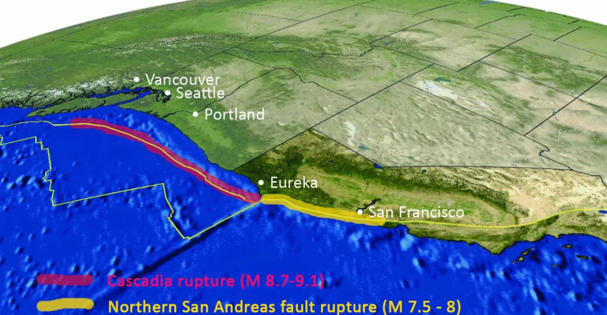
Chris Goldfinger stated on 13 October 2025, “We could expect that an earthquake on one of the faults alone would draw down the resources of the whole country.”
A simultaneous San Andreas event could strain emergency response across California, Oregon, Washington, and British Columbia, multiplying casualties and resource scarcity.
Four States Face Total Risk

California, Oregon, Washington, and Idaho—plus Vancouver Island—fall within the direct impact zone. Coastal cities will experience tsunami inundation; inland cities face violent shaking.
The geographic sweep ensures that millions are at risk simultaneously. The scale eclipses any recent American natural disaster.
The Most Dangerous Hub
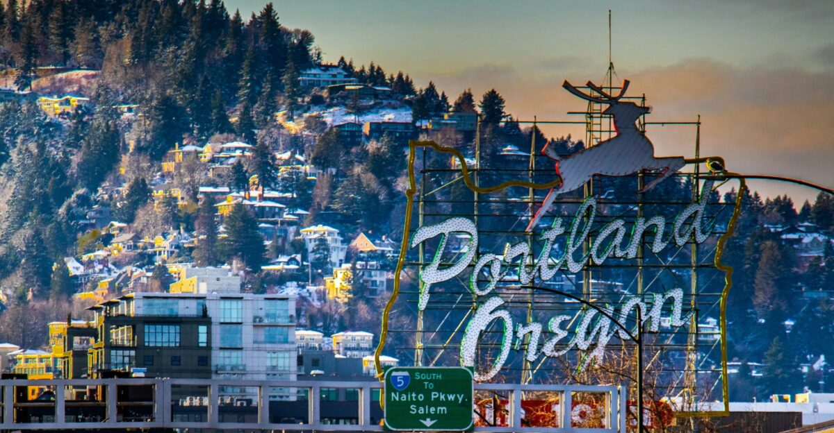
Portland’s 6-mile CEI Hub contains 90% of Oregon’s liquid fuel and PDX airport jet fuel. Tanks sit on liquefaction-prone land built in the 1960s–1980s.
Fuel shortages will cripple emergency aid. When the hub fails, regional recovery and national supply chains falter. This illustrates how concentrated risk can magnify disaster impact.
Cascadia’s Overlooked Power
Magnitude 9.2 is possible because the full 600-mile fault can rupture at once. This surpasses San Andreas’ 8.2 maximum. Energy release is 16 times greater on the Richter scale.
Despite historical silence, the Pacific Northwest faces an unprecedented seismic threat. Preparation has lagged far behind potential consequences.
Why the Pacific Northwest Is Unprepared
Building codes, critical infrastructure, and coastal development lag decades behind the hazard. Most hospitals and schools were built before modern seismic standards were established.
Seismic awareness is relatively new, compared to California’s century-long preparation. This gap leaves populations and infrastructure exposed when the inevitable strike occurs.
Recovery Will Take Years
Electricity restoration may take 1–6 months; water/sewer 1–3 years. Coastal hospitals may remain closed permanently. Economic recovery in southern Oregon and the Portland Metro will lag 10–30% below prequake levels for seven years.
Infrastructure rebuilding and population resettlement will extend beyond a decade. However, understanding how nationwide systems fail highlights the full scope of the disaster.
Government Response Limits
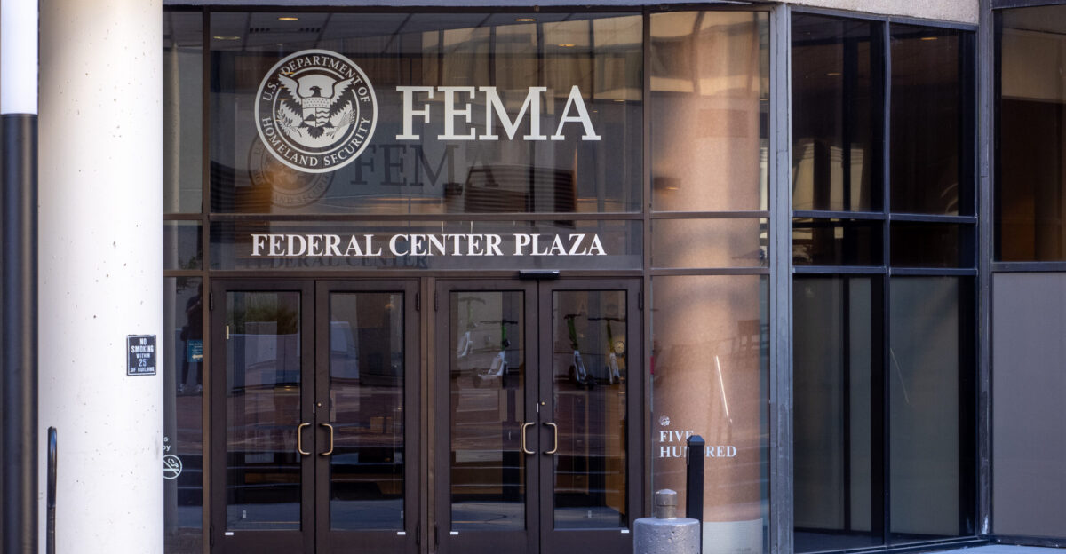
FEMA Region X covers 900,000 square miles. Kenneth Murphy’s July 12, 2015, quote reflects a limited capacity: “Everything west of I-5 will be toast.”
Healthcare, emergency services, and interstate coordination will struggle. Cascadia demonstrates how even national agencies cannot fully mitigate a megathrust disaster of this magnitude.