The National Hurricane Center recently warned that the period from September 17 to September 30, 2025, carries a much higher chance for tropical cyclones to develop, especially in the eastern Atlantic and the northwest Caribbean and Gulf of Mexico.
This alert comes after a surprisingly quiet hurricane season, with September 10 usually considered the high point for hurricane activity. Meteorologists say the quiet stretch is ending as warmer waters and changing atmospheric trends will help hurricanes form quickly and possibly grow strong.
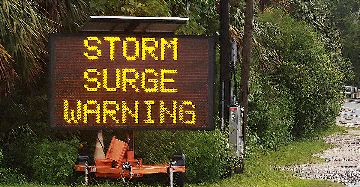
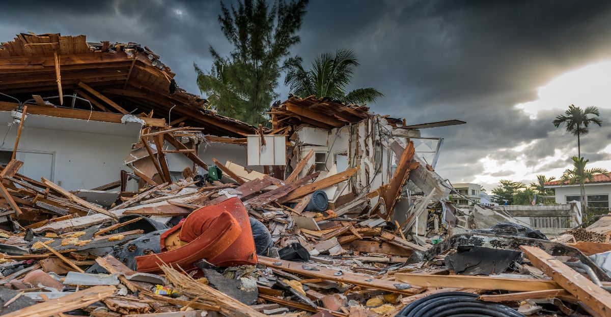
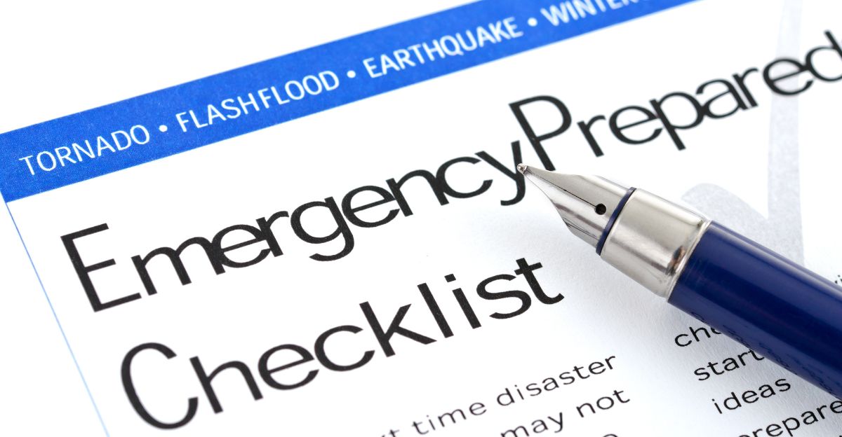
Emergency officials have urged people living along the coast to finish their hurricane preparations immediately.
Silent Season
The 2025 hurricane season for the Atlantic started in an unexpectedly calm fashion. Usually, by mid-September, there would be eight named storms, but as of now, just six have appeared.
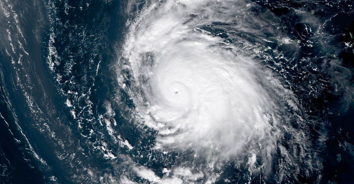
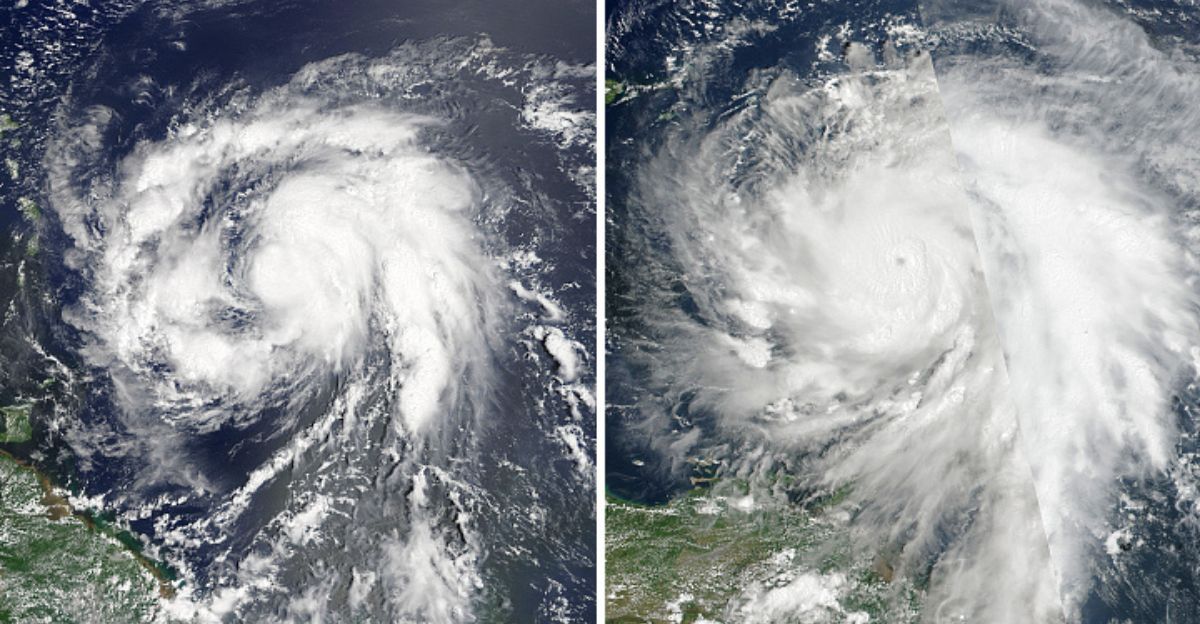
Only Hurricane Erin reached hurricane status, becoming mighty thanks to an unusual burst of intensification in August. The most recent storm to get a name, Tropical Storm Fernand, faded away on August 28. That created the most extended mid-season quiet period since 2016.
Experts believe this calm was mainly due to strong Saharan dust blowing across the Atlantic, dry air, and winds that prevented most storms from forming or strengthening.
African Dust Shield
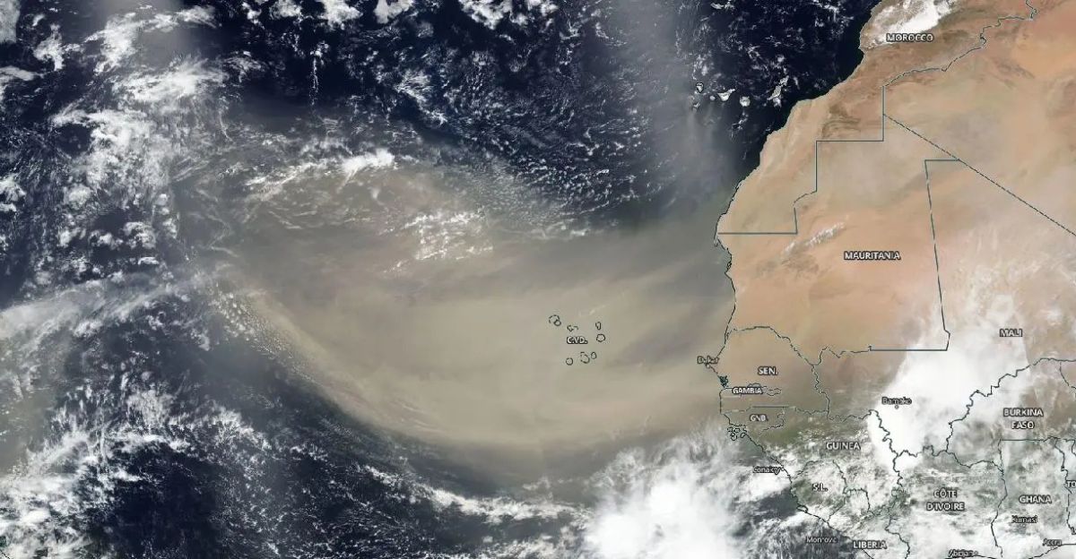
Vast clouds of dust from the Sahara Desert floated across the Atlantic this year, significantly keeping hurricane numbers low. These dust clouds contain air with much less moisture, making it hard for thunderstorms and hurricanes to build up.
The dust also disrupts how storms organize, pushing them apart or tilting their structure. However, dust outbreaks from Africa gradually fade after mid-August, so the usual protection may not last much longer.
Satellite images show that dust levels are much lower than earlier in the summer, suggesting hurricane activity could increase as this “shield” disappears.
Warming Waters
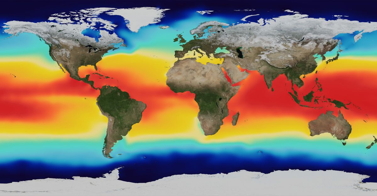
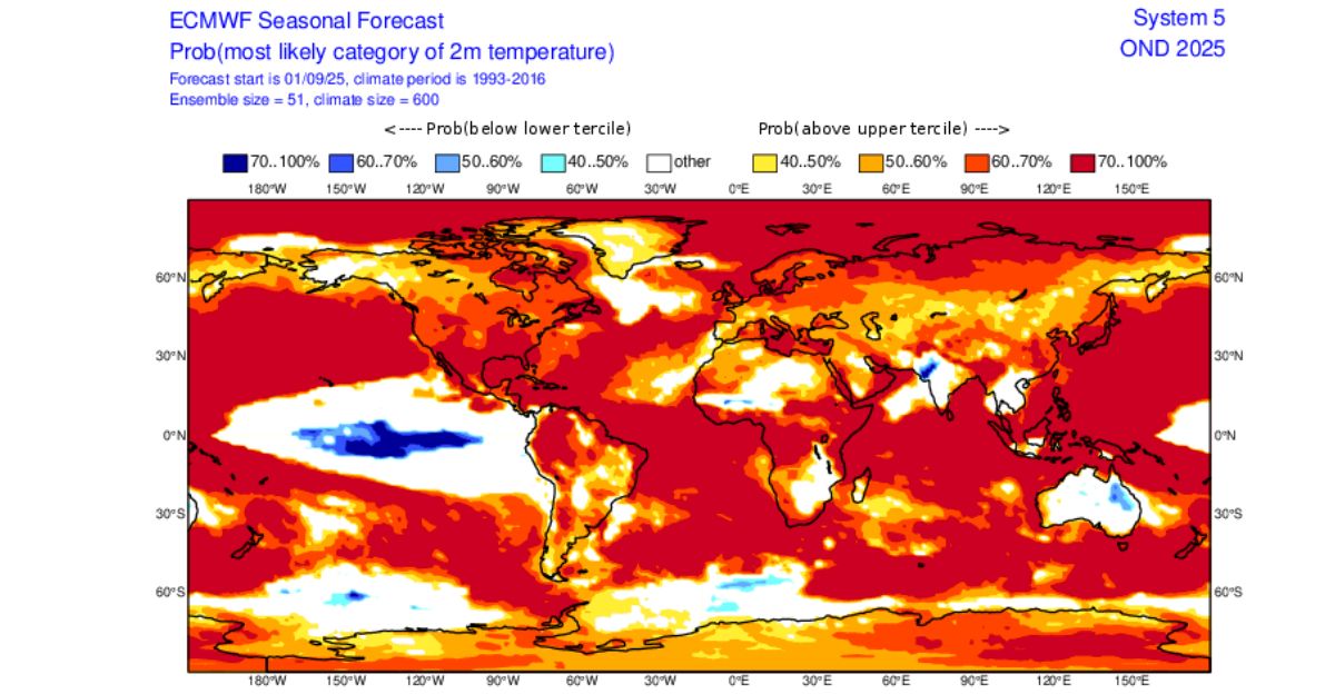
Ocean temperatures in places like the Gulf of Mexico and the Caribbean Sea are warmer than ever, even up to 90°F in some locations. That’s much higher than the 80°F benchmark typically needed for hurricane formation.
Not only are the surface waters hot, but deep water below is also much warmer than usual, giving storms extra fuel to intensify. Recent readings from Florida’s Gulf Coast show water temperatures between 84°F and 88°F, with the Atlantic coast hovering just above 80°F.
Scientists say these elevated temperatures partly result from rising global temperatures, setting the stage for intense hurricanes like Erin, which rapidly intensified thanks to warm waters.
The Forecast Window

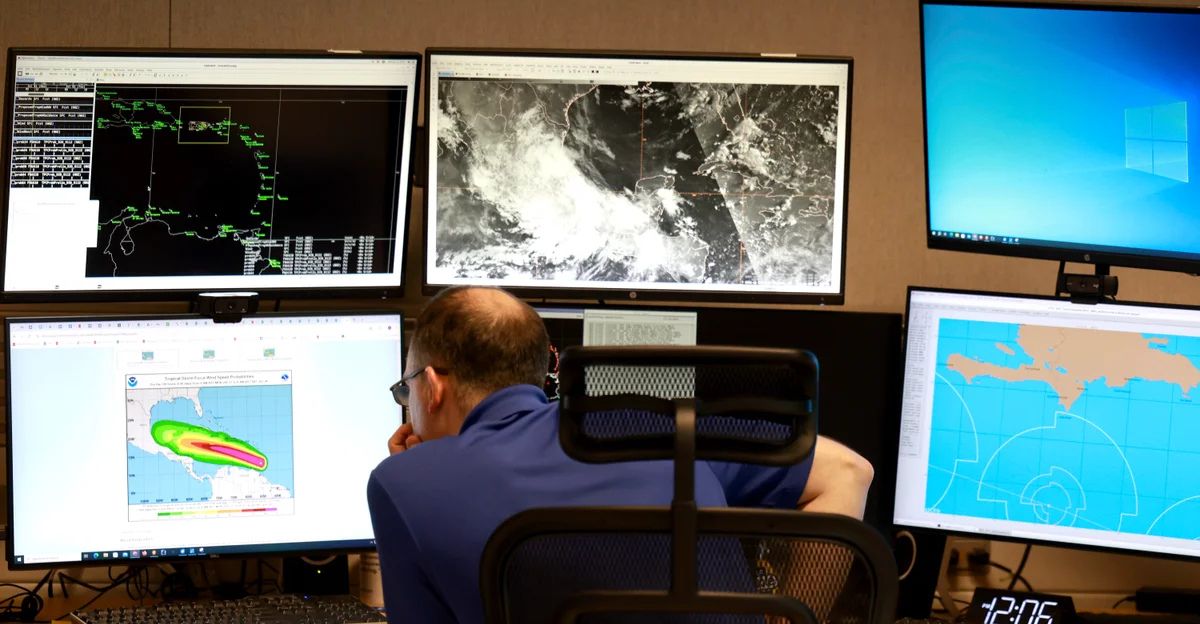
Meteorologists at NOAA and other forecasting centers have marked September 17-30 as the next critical window for storm formation.
In particular, an intense tropical wave from Africa is expected to develop around September 20, offering the highest chance for a new storm to form.
The probability for a storm starting in the eastern Atlantic is as high as 60% during this period. Lead forecaster Alex DaSilva says the quiet stretch is ending, with multiple weather models supporting the odds of new tropical development.
While exact timing and storm strength are unknown, forecasters agree that activity will increase.
Coastal Communities Brace

Emergency managers are urging residents to prepare in hurricane-prone regions like Texas, Louisiana, Florida, and all along the Atlantic coast up to Maine.
Florida’s emergency services have increased their monitoring and have reminded all 21 million state residents to prepare. Louisiana officials have updated evacuation routes and shelter plans, knowing that Gulf storms often grow very strong very quickly.
Outer Banks communities in North Carolina prepare early to avoid being caught off guard. With its active tourism season, the Caribbean is also making contingency plans in anticipation of possible storms.
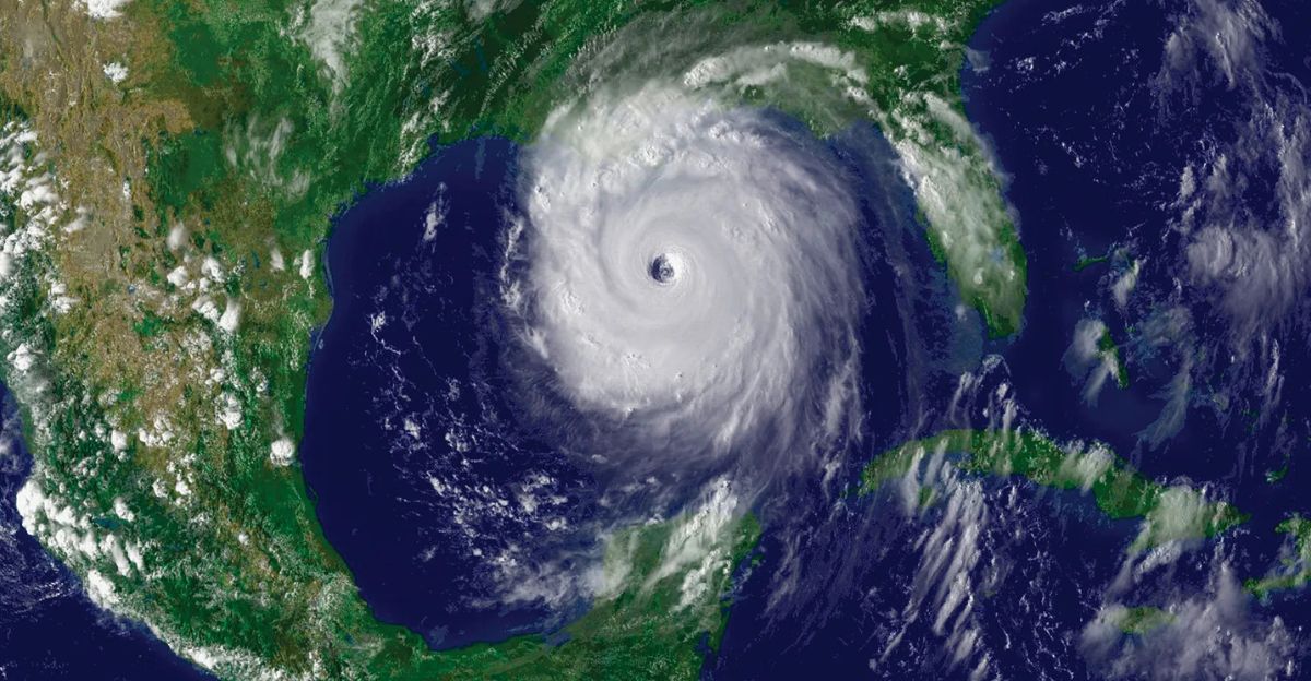
Gulf Threat Zone
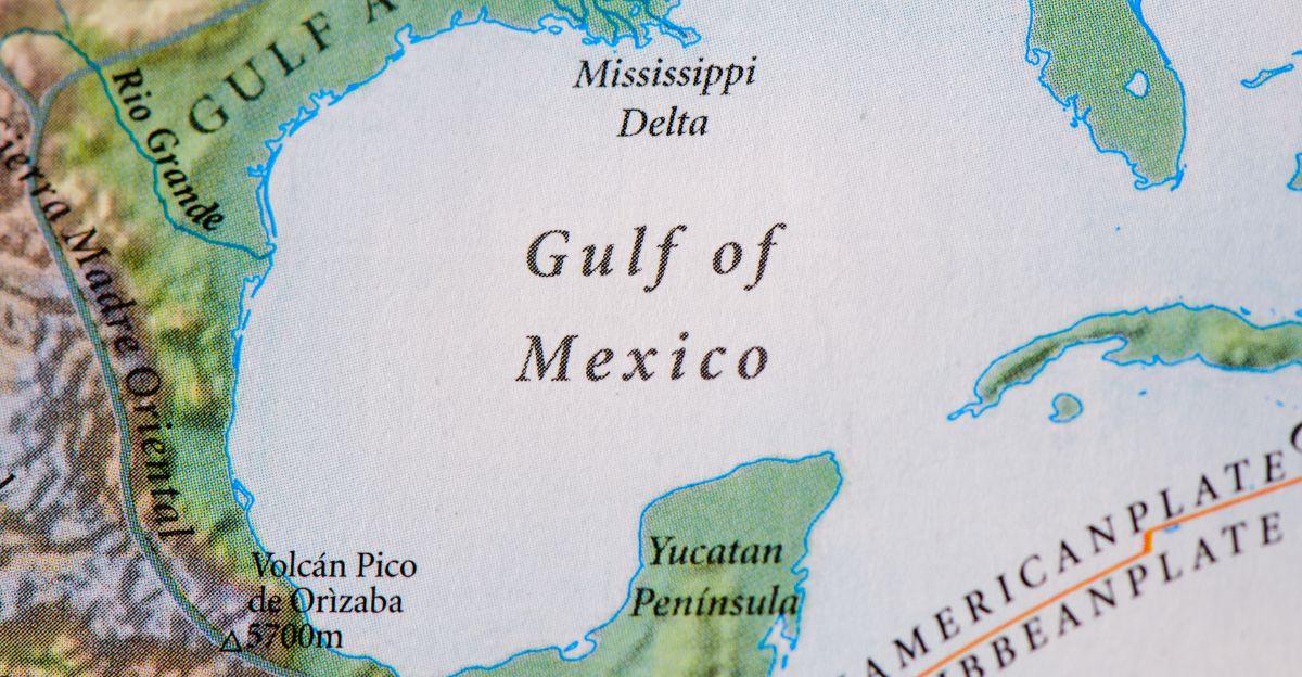
The waters in the Gulf of Mexico are especially warm and deep right now, making it a hotspot for sudden hurricane growth.
In past years, hurricanes in the Gulf have gone from weak tropical depressions to major hurricanes in just 24 to 48 hours, a pace that severely limits how long coastal populations have to evacuate.
Current data show ocean heat content at unprecedented levels, and wind and moisture patterns favor rapid storm development.
As a result, areas from coastal Texas to the Florida Panhandle may be particularly vulnerable this month.
Rapid Intensification Trend
Climate change has made Atlantic hurricanes much more likely to become stronger. Today, storms are nearly 30% more likely to increase wind speeds by 35 mph or more in a single day compared to decades past.
Hurricane Erin is a prime example because it became a major hurricane just 24 hours after being classified as a Category 1. This rapid intensification is most likely when storms move over warm waters and meet little wind interference, precisely the conditions expected now.
Scientists warn that such quick changes pose serious challenges for emergency plans, since the usual preparation window may not be enough.
La Niña Factor
Meteorologists are watching for the possibility of La Niña, a climate phenomenon that typically boosts hurricane activity across the Atlantic. During La Niña, wind patterns change, so fewer winds appear to “cut off” hurricanes before they form. NOAA says there’s a 71% chance that La Niña will develop in the last few months of 2025, possibly keeping hurricane season active longer than usual. When La Niña is present, storms grow faster and are more likely to move toward the U.S. mainland or Caribbean, increasing risks for landfall and damage.
Model Convergence
This season, computer models that simulate the weather consistently show increased chances for storm formation in mid-to-late September.
Major systems all agree that an intense tropical wave from Africa will meet favorable conditions beginning around September 18-20. Hurricane experts say this model agreement is unusual, meaning forecasters are more confident than usual.
Consistent across models means this window likely contains real risk, not just a statistical blip.
Industry Response

Enormous energy, shipping, insurance, and travel companies are already taking steps to minimize the impact of hurricanes.
Oil and gas firms in the Gulf of Mexico are activating safety protocols to protect workers and equipment. Insurance companies review coverage terms and risk in coastal areas, while port authorities and shipping lines prepare alternate plans to safeguard cargo and people.
Cruise lines and airlines operating in the region are flexible with bookings and routes and are ready to make last-minute changes to avoid a direct hit.
Historical Context
History shows that the most dangerous hurricanes often form late in the season, when ocean waters are still hot and atmospheric conditions become more favorable.
In recent years, like 2018, 2005, and 2020, powerful late-season hurricanes have multiplied and caused significant destruction. Statistical research confirms that storms forming after September 15 are more likely to become major hurricanes.
This year, the combination of factors matches conditions from other years with record-breaking late hurricanes.
Emergency Preparedness

Emergency organizations like FEMA and the Red Cross are moving supplies and teams to strategic spots along the coast, preparing in advance for any storms.
Hospitals in cities from Houston to Miami are planning for disaster scenarios, reviewing how they would evacuate patients or expand their capacity quickly. Schools and local government offices in vulnerable areas are readying plans for closures and shelter operations.
Communication networks are being tested, and volunteers are mobilized to ensure help can reach people quickly if a storm hits.
Atmospheric Patterns
Multiple weather patterns are coming together to make storm formation likely. Upper-level winds are easing, lowering the “vertical wind shear” that hurt storm development earlier in the season.
The Madden-Julian Oscillation and other global patterns are shifting, and subsidence is waning. More atmospheric moisture is available as pressure systems stabilize, helping thunderstorms to form and organize.
These shifts add to what meteorologists call a perfect storm for tropical cyclone odds in the coming two weeks.
Looking Ahead
September 17-30 is the most critical period for hurricane development this year. If La Niña arrives as expected, favorable conditions may last until November.
While most of the season has been quiet, just one major hurricane could cause massive damage and raise the season’s overall numbers. The risk is higher now than earlier this year, with warm water and supportive weather patterns lining up.
History suggests late-season storms are especially likely to hit populated areas, meaning millions should stay alert until hurricane season ends on November 30.
Research Developments

Better technology is now helping meteorologists forecast hurricanes more accurately. Airplanes called Hurricane Hunters are being readied to collect new types of data, measuring ocean and air conditions with greater detail than ever before.
Advanced artificial intelligence models let forecasters spot rapid intensification events days ahead, especially for storms that can grow quickly.
New studies teach scientists more about how Saharan dust blocks storms, while better satellites provide a real-time global view so forecasters can warn communities earlier.
Economic Implications

Farmers, business owners, and government agencies are bracing for economic impacts. In agricultural regions like Florida and Texas, the harvest is being sped up to avoid hurricane damage.
Coastal tourism businesses are preparing for cancellations or evacuation orders. Energy companies are at risk, since Gulf oil production is a significant part of the U.S. supply.
Insurance rates may be adjusted as new forecasts arrive, and port authorities are getting ready to deal with interruptions to shipping and critical supply chains.
Social Media Response

Meteorologists and emergency professionals push out preparedness information to counter rumors and false forecasts on social platforms.
Viral how-to videos for hurricane kits and evacuation plans are widely shared, especially among younger people. Scientists also use social media to explain why global warming is strengthening some hurricanes.
Some conspiracy theories and misinformation persist, so officials monitor them closely to ensure people get accurate, practical guidance.
Historical Parallels
Meteorologists draw direct connections between this quiet 2025 season suddenly becoming risky and infamous late-season hurricane years like 2005, which was named Katrina and Rita, or 1992, which was named Andrew.
These years started quietly, only to produce destructive storms when conditions changed late in the season. Both warm water and changing atmospheric conditions led to rapid storm formation, just as is predicted for the coming weeks.
The lesson: an uneventful start can quickly shift to major threats, so complacency is dangerous for coastal residents.
Highest Hurricane Risk of the Season
In summary, from September 17 to September 30, conditions are primed for hurricanes to form quickly and potentially become very dangerous.
While the season has been quiet, a dramatic shift is expected, meaning coastal residents in at-risk areas should use this time to prepare and protect themselves, their property, and their families. If storms do form, they could become strong in just a day or two, leaving less time for last-minute plans.
The elevated risks for significant hurricane activity are as high as they’ve been all year. Taking action now is the best way to prevent harm in the weeks ahead.