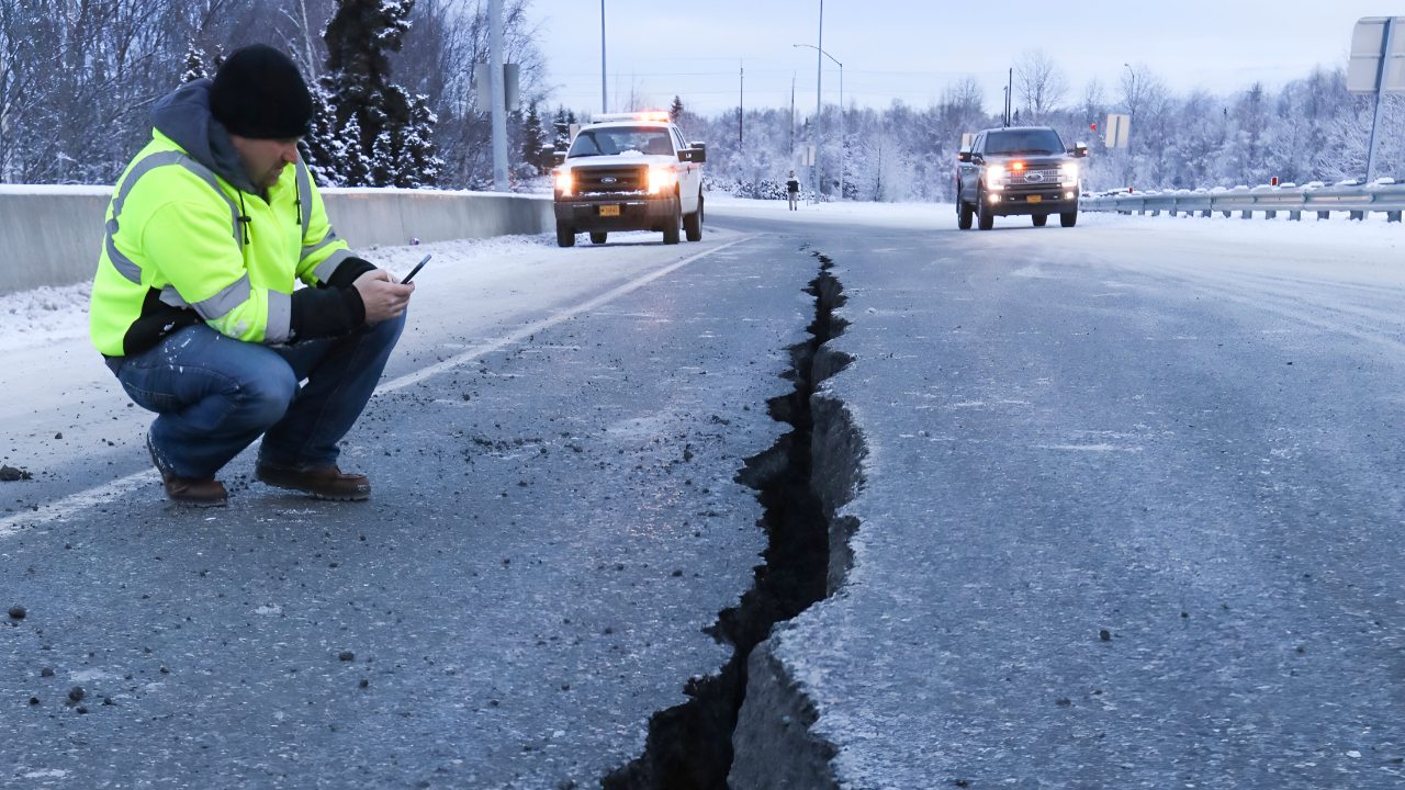
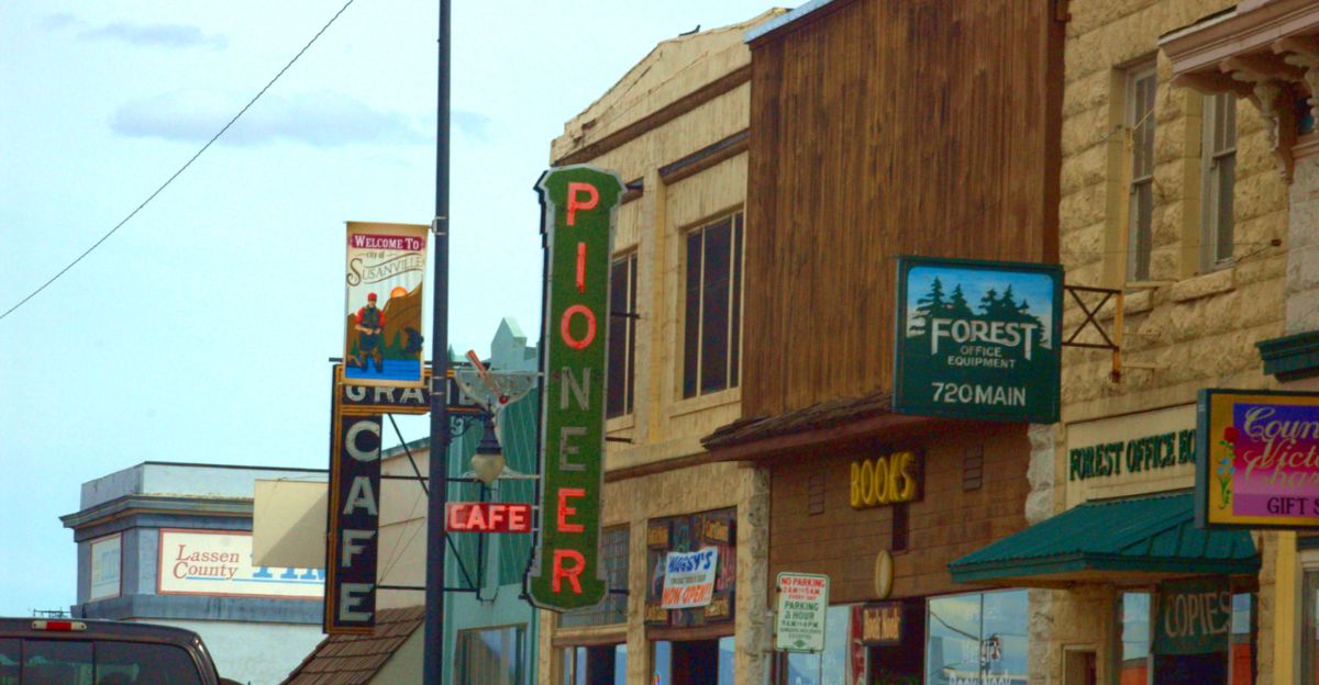
Susanville was just another quiet night until the ground started to move. A magnitude 4.9 earthquake struck just after 9 p.m., and within seconds, phones across California and Nevada buzzed with an urgent message: drop, cover, hold on.
For the 12,000 people in this small mountain town, it was real. For the California Earthquake Early Warning System, it was proof that every second matters.
When Seconds of Warning Change Everything
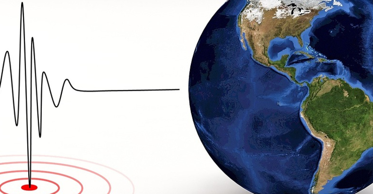
The epicenter was just 9 miles away—close enough to feel immediately. Scientists call this a “shallow” quake because it ruptured only 3 miles underground, resulting in sharp and direct shaking. ShakeAlert detected the rupture and calculated what was coming, then sent alerts before the worst shaking arrived.
Some residents got 30 to 60 seconds of warning—enough time to move away from windows, grab a child, or get under a table. Those seconds aren’t dramatic, but they’re the difference between safe and sorry.
A Night That Rattled More Than Just Dishes
In homes throughout Susanville and its surrounding communities, the quake made people take notice. Dishes rattled. Picture frames tilted. People who’d lived through California earthquakes before knew exactly what was happening.
First-time earthquake visitors felt their hearts skip a beat. Emergency officials reviewed the data and reported that most buildings held up fine. The USGS issued a green alert—low probability of fatalities or serious damage. In Reno and Carson City, Nevada, most people barely felt anything.
Three Quakes in Seven Days
This wasn’t an isolated jolt. Just two days before Tuesday’s main event, a 4.7-magnitude quake had already shaken the same area. In the days that followed, smaller aftershocks kept arriving—2.0, 2.3, another 2.1—each one a reminder that the earth was still adjusting.
For residents already on edge from the first two significant quakes, there was no real moment to relax.
Why Shallow Makes a Difference You Can Actually Feel
A quake’s depth matters more than most people realize. When an earthquake ruptures deep in the crust, energy dissipates gradually as seismic waves travel upward through rock and soil. However, when it ruptures close to the surface—such as this one at a depth of 3 miles—the shaking is sharper and stronger.
People 30 miles away sometimes felt this quake more intensely than people closer to the deeper quake epicenters. The shallow depth meant the shaking was immediate and sharp.
The Phone Alert
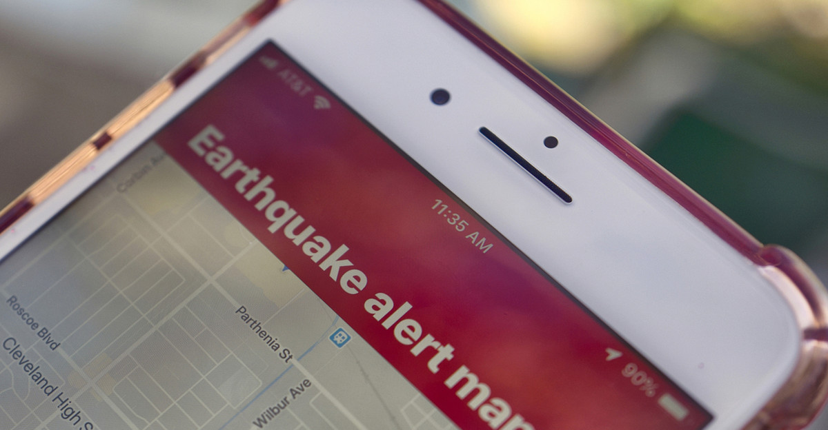
Phones across the region received emergency alerts on Tuesday evening. For many Californians used to earthquakes, it was routine. But for tourists, business travelers, and parents with sleeping children, the sudden phone alert was genuinely frightening.
Social media filled with people saying they felt the alert before feeling the quake—exactly how the system is supposed to work.
The Brick Buildings Nobody Wants to Talk About

Beneath the reassuring green alert and “minimal damage” reports, emergency managers were quietly thinking about older buildings. Throughout Northern California, historic downtown districts and charming old hotels are situated in brick structures built before earthquake codes were established.
A 4.9 quake doesn’t demolish these buildings, but it stresses them—strains the mortar in brick walls, shifts the foundations slightly, and weakens them for the next quake.
The Invisible Anxiety Machine
Warnings continued to come: aftershocks could arrive at any time. This isn’t scare tactics—it’s geology. When a fault ruptures, stress redistributes along the fault line, sometimes triggering smaller quakes as the earth adjusts.
Most aftershocks are weaker than the main event, but not always. For people already feeling raw from the initial tremor, the possibility of another compound the stress.
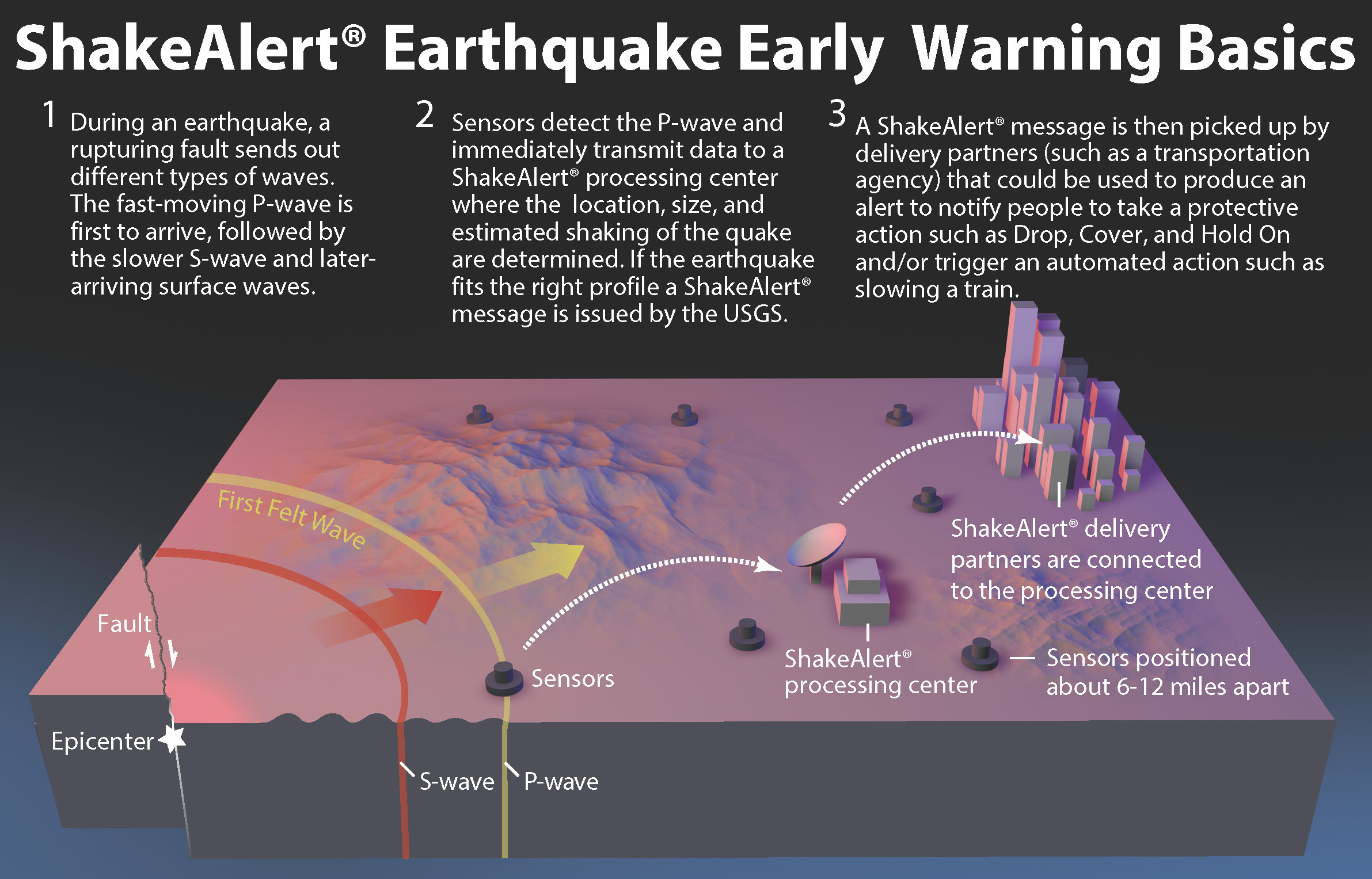
The Network That’s Always Listening
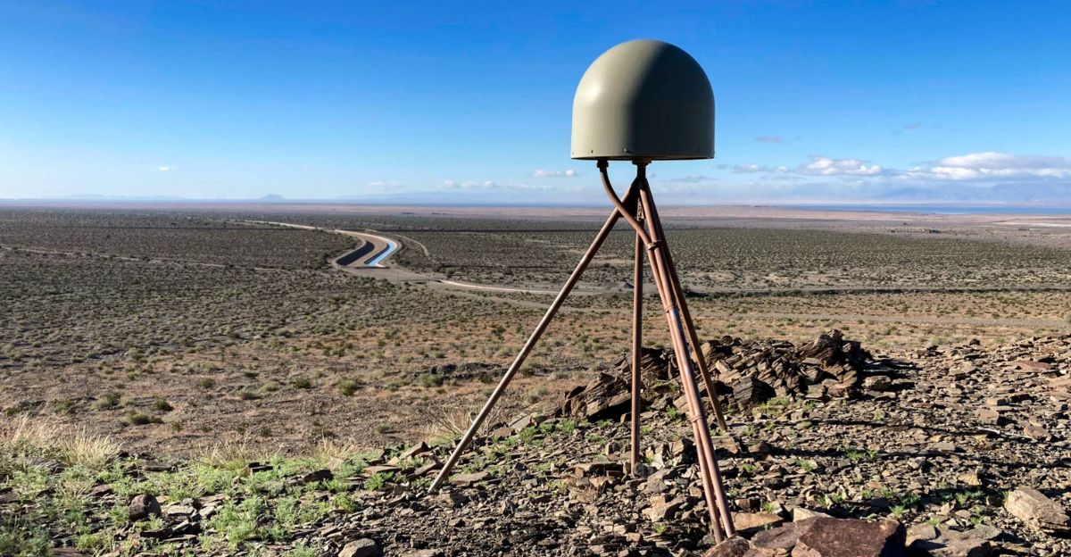
California’s early warning system is staggering. Over 1,000 ground motion sensors are deployed near active faults across the state, constantly feeding data to processing centers.
When an earthquake ruptures, these sensors detect it immediately and send readings through fiber-optic cables to computers that have only seconds to calculate the location, magnitude, and expected shaking intensity.
How a 30-Second Warning Saves Lives

In hospitals across the shaking zone, automatic systems kicked in the moment ShakeAlert sent its signal. Elevators descended and stopped. Surgical teams moved from operating tables. Equipment got secured.
Fire station doors unlocked so they wouldn’t jam. Transit systems slowed trains. For someone at home, 30 seconds is enough time to drop to hands and knees, crawl under a sturdy table, and hold on.
Living in Earthquake Country Means Living Differently

For native Californians, earthquakes are part of life’s rhythm. Kids practice earthquake drills at school. Families bolt heavy furniture to walls. People keep earthquake kits in cars and homes—water, first aid supplies, and a radio. A
fter multiple quakes, you develop instinct: you feel that first rumble and instantly know whether to brace or shelter. You learn which rooms in your house are safer. You recognize the difference between foreshocks and aftershocks just from how they feel.
The Numbers That Put It in Perspective

Northern California experiences approximately 25 magnitude 4.0-5.0 earthquakes every year on average. That’s not rare—that’s background noise. Over the past decades, dozens of magnitude 5 quakes have rattled the region.
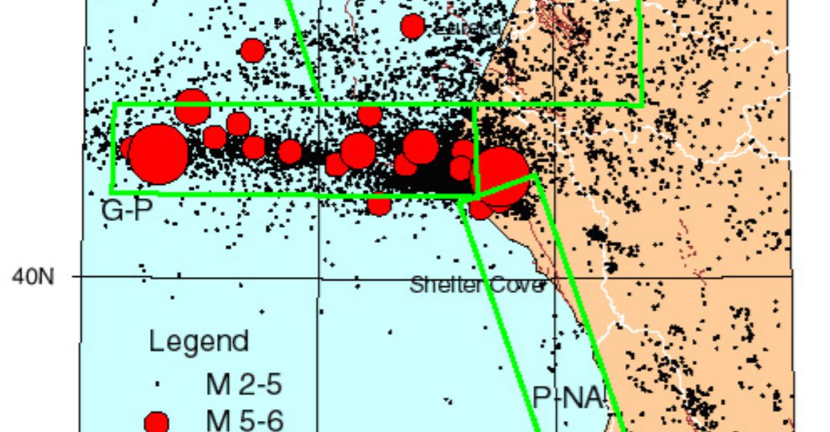
The Mendocino Triple Junction, where three tectonic plates converge, virtually guarantees continuous seismic activity.
Why the First Report Said 5.3, Then Changed to 4.9
When ShakeAlert detected the quake, automated systems quickly estimated its magnitude to be 5.3. That number was initially reported in alerts and subsequently spread through media reports. But as seismologists reviewed data from all 1,000 sensors, they refined their analysis and revised the official magnitude to 4.9.
This is normal—preliminary magnitudes are educated guesses made in seconds. Real magnitude comes from careful analysis.
Beyond Ground Shaking
A quake’s real danger sometimes isn’t the shaking itself. Landslides on hillsides can block roads and destroy homes. Liquefaction—where saturated soil temporarily loses strength during shaking—can cause buildings to sink and pipelines to rupture.
Northern California’s mountains, valleys, and high water table areas mean these secondary hazards are real possibilities. It’s work that doesn’t make headlines but prevents disasters.
The Quiet Work of Preparation

For seismologists, the quake sequence provided fresh data about how this fault system behaves. They’ll analyze sensor readings, add another chapter to understanding Northern California’s seismic character. For emergency managers, it was a real-world test of alert systems and protocols.
For Susanville residents, life slowly returns to normal with awareness that the earth is never truly still. Each quake, each alert reminds us that preparation matters.
Sources:
U.S. Geological Survey (USGS) Earthquake Hazards Program – Real-time earthquake data, magnitude revisions, and ShakeAlert system specifications
California Governor’s Office of Emergency Services (Cal OES) – California Earthquake Early Warning System operational details and alert protocols
USGS ShakeAlert Program Documentation – Early warning system sensor network architecture and alert dissemination procedures
California Earthquake Early Warning Program Official Resources – Statewide emergency alert distribution and public safety guidelines
USGS Earthquake Damage Assessment Reports – Post-event structural vulnerability analysis for Northern California regions
Lassen County Emergency Management – Local response documentation and community impact assessment